I’m a fairly lazy person, and the Internet only augments that in me. If I can find something online, I would rather do that in my jammies sipping a gin and tonic at 10:00 pm on a Saturday than get to the library to look up an address in the 1905 business directory at 2:00 pm. Which would take me all of two minutes. Much rather be at home.Luckily there is so much available on the Internet. Not everything, which is one of the reasons I’m doing this blog, but enough to get one started.
I’m a very visual and spacial person, and using my eyes, I realized that none of the buildings till on my block were from 1900-1910. So, I couldn’t start with photos, but I could start with a map. There are a couple of places to find historic maps of Seattle. Of course Seattle Public Library is a fantastic place to start. They have a bunch of different kinds of maps, (check them out here.) but I like the digital Sanborn maps. These were created to help fire insurance companies to assess risk in insuring a particular property. Similarly the 1912 Baist map at Paul Dorpat’s site or the 1905 Baist Map at Seattle Public Library are insurance maps that can tell a lot about a place. I tend to start at the 1912 Baist map because of it’s ease of use. It is high definition and one can save it to the computer, which is more convenient. Since it is from 1912, and our decade ends in 1910, I used it as a way to see what was there at the end of the decade. I wanted to see what was there at the beginning.
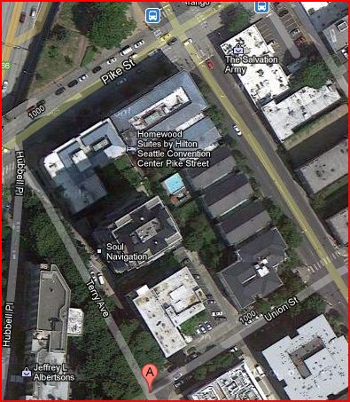
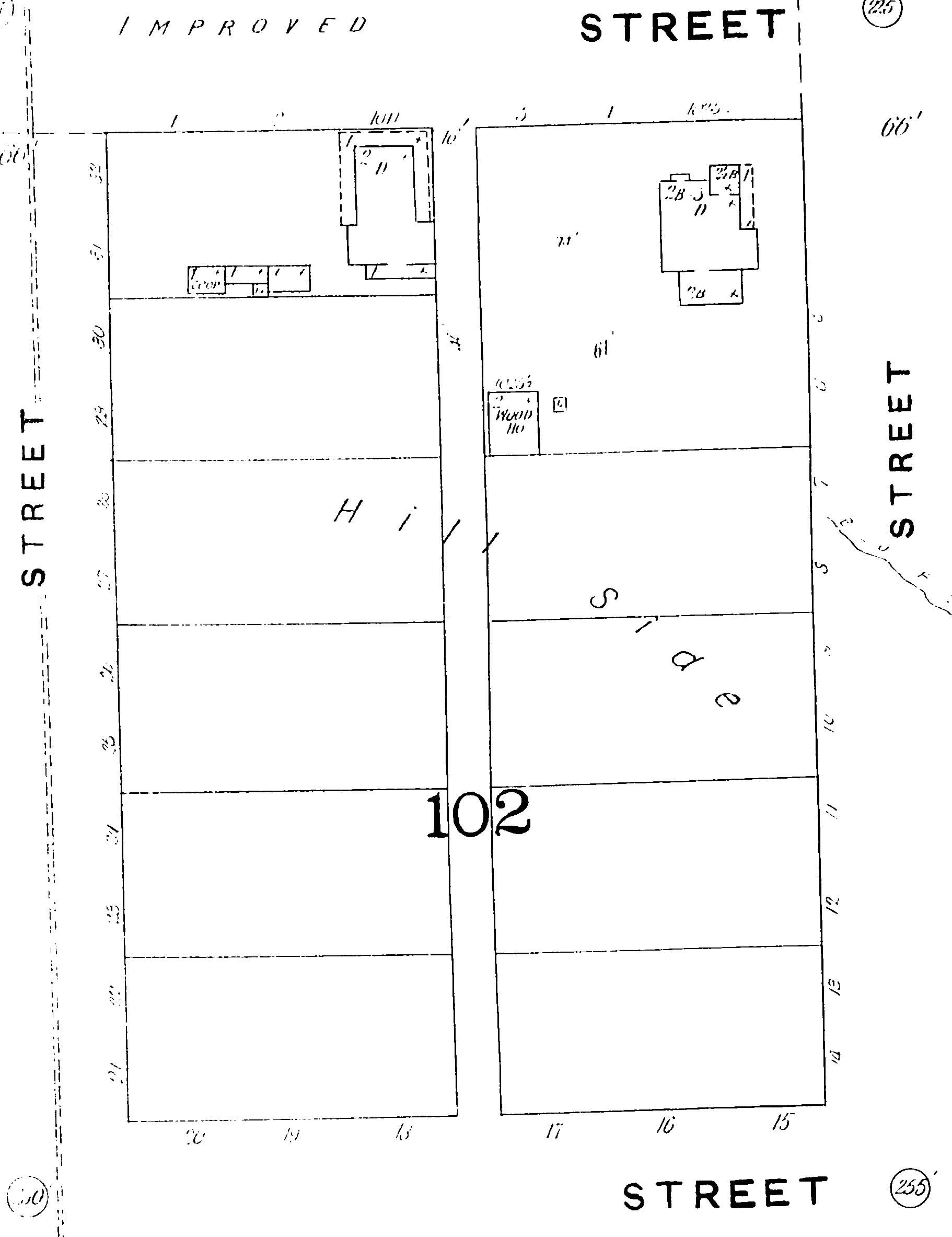
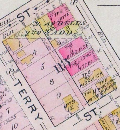
The Sanborn maps at the library are from 1893 and 1905. That would give me some sense as to what the block looked like a few years before 1900 and in the midst of our decade. So, here, in the order I looked at them, are the four maps I used when researching this block.
The 1893 Sanborn map shows very little going on on this block. (Note: Pike Street is to the top of the photo, Boren to the right, Terry Ave to the left, and Union St on the bottom.) That makes sense. At the time, it was a bit out in no-man’s land, quite a distance from Pioneer Square, the shipyards or even the schools (Although Summit School would open not too much later a few blocks to the east). The two buildings that are there are facing Pike Street. Union is up a very steep hill and I am not at all shocked no one wanted to build up at the top if they didn’t have to. I can speak personally when I say that going up Terry Ave every day is a pain. One thing to note: I think that the building at the corner of Boren and Pike still exists… just not at this location. But more on that later.
The 1912 Baist map, on the other hand, shows a full block. Only Terry Ave has relatively few buildings on it. Remember the hill? Ugh. But Boren Ave is chock full of buildings and the other thing to notice, these are mainly apartment buildings. This goes a good way to showing how much Seattle’s population had grown in the roughly 20 years between these maps. The Yukon Gold Rush happened during this time, as well as the Alaska-Yukon-Pacific Exposition, Seattle’s first World’s Fair in 1909. Seattle was hopping and Block 113, near to the new shopping district of lower Pike/Pine would have drawn people to live there.
It was this map that gave me my first clue as to the building that used to be the site of my current residence. On this map, many of the apartment buildings are named, which I’m sure will prove super helpful in the future, but I was looking at the corner of Terry Ave and Union St. As you can tell from the map, there is no building right on the corner. I blame the hill again, but a little to the northeast, there is a building (the one with “APTS 12” The 12 refers to the lot number of the block.) and it is one of the few buildings that isn’t named. But there is an address! Sticking out perpendicular to the street is a four digit number. That building was 1010 Union St. Huzzah!
To get an idea of when it was built, because “somewhere between 1893 and 1912” is a tad vague for me, I looked at the 1905 Baist map at SPL as well as the Sanford map of 1905. Here they are.
So now we have a least a bit more knowledge that 1010 Union St was built before 1905. Narrowed it down to a decade roughly, but that’s pretty good.
From here, since I was still being lazy, I went to my old friend, the Seattle Times Digital Archive, reachable through my better, older friend, the Seattle Public Library’s website. Doing a search for “1010 Union St.” yielded this gem in the July 5th 1905 edition:
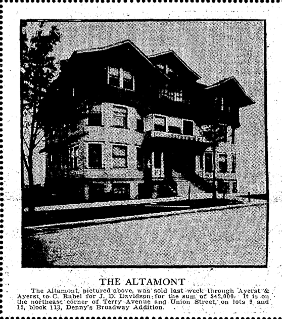
I’m going to be honest, this doesn’t seem like the best employment. No room? Only $30 wages and board. No thanks! (Also, this ad was run a lot, meaning they weren’t getting too many takers.) So there you go, the first mention of this address in the Seattle Times and what’s more, a name! This prime address was called the Altamont. One last search for “Altamont” brought up this surprise from the May 6th 1908 edition of the Seattle Times:
Isn’t she lovely?
Next time, we’ll delve a little deeper in to the Altamont’s story, if I can get my butt over to the library.


